


Cry me a River
What the "NIO report" on the Mhadei diversion says and does not say, a cartographic data visualisation document of Goa and the trouble with Michael Lobo. This and more in this week's edition.

Welcome to yet another edition of Gerard’s Gazette, a weekly newsletter in which I attempt to break down the events of the week gone by and offer a bit of context, as well as a dose of news you may have missed and news behind the news.
If this is your first time here, thank you for signing up, and I hope you stick around!
Cry me a River
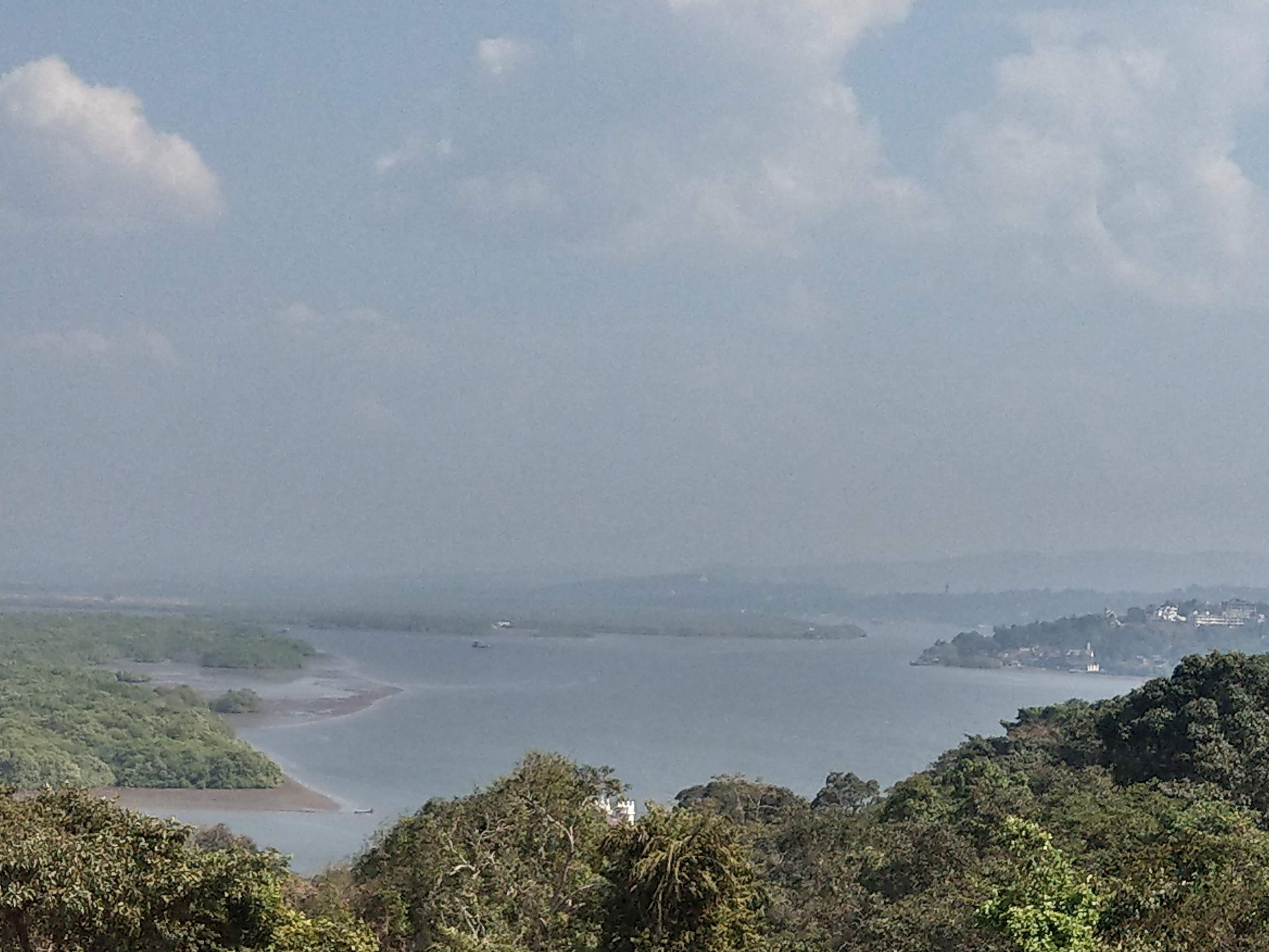
Three hydrologists -- one currently with the NIO and two others who moved on -- decided to publish a paper in an academic journal based on a rainfall mapping and runoff model that they developed and everyone’s losing their minds.
Allow me to explain.
Earlier this week, on Monday to be precise, my story on a paper published by the three hydrologists -- K Anilkumar, D Shankar and K Suprit -- went online.
And much like everything we see in the media today, each person interpreted the article in a manner that was advantageous to his/her own ends. And given that, context is often lost, (as was on full display this week), I thought I’d elaborate a bit on the so called “NIO report”, what it is, what it is not, what it means and what it does not mean for Goa, Karnataka and the people who depend on this water.
For starters, let’s get a few things that should have been obvious, out of the way.
This is not a “report” nor is it “by NIO”. It wasn’t commissioned by the Goa government or the institution, and, as things stand, has no legal bearing on the ongoing dispute. This is an academic paper published in a peer reviewed journal that has simulated the water budget (how much water there is) of the Mhadei basin in order to be able to estimate (with a fair degree of accuracy) what will be the flow in the river at any given location on any given day in the year.
This exercise is nothing new. In fact, a similar exercise was done by the Tribunal itself prior to pronouncing its award, in order to help it arrive at a decision on how much water Karnataka could divert and from which tributary in a manner that was fair and not too damaging to either of the states’ interests and the environment.
What’s different this time is that the NIO hydrologists used a model that is said to be superior to the one used by the Tribunal because they used improved rainfall distribution data and incorporated the impact elevation has on rainfall. For example in the Western Ghats, the windward side of the mountains receive significantly more rainfall than the leeward (school geography). In such a location, where the amount of rainfall received by two places seemingly close to each other can vary widely (depending on which side of the ridge they fall) using a broad, generalised model as used by the Tribunal that extrapolates rainfall data as measured by a gauge over a wide area (several square kilometres) doesn’t really work.
And so, long story short, what the model concluded was that diverting water from a location that falls on the leeward side of the Ghats will not make much of a difference to Goa simply because those locations do not get much rainfall in the first place (as compared to the windward side of the Ghats). That, in essence, is the sum and substance of the paper.
The other thing that seemed to have got lost in the playground of passionate opinions is that the findings of this study were based on the probable impacts on Goa were Karnataka to divert water in quantities permitted by the Tribunal. Should Karnataka begin diverting water as much as they had initially sought to divert, the impacts could be significantly higher. I’m sure the hydrological model would be able to simulate that scenario as well.
Most people (journalists included), unfortunately, only read newspaper headlines. Only few read the article in its entirety and even fewer still read the underlying paper that the news report was based on. Were they to do that, they would know that the scientists were of the strong view that “prescribing a floor on the discharge downstream, is still as essential as the cap on the diversion.” Which means that while it was fine for the tribunal to limit the amount of water that Karnataka could divert, what was equally necessary was for them to prescribe a minimum flow of water from the dams downstream -- something the tribunal hasn’t done.
I wasn’t sure what the reaction to the report would be, since it was published on a platform that has limited local visibility. But the Revolutionary Goans Party (RG), allayed all such fears. The party’s bosses addressed a press conference with a list of grievances against the NIO, the scientists and the Goa government.
The NIO and the scientists, they said, were enjoying the fruits of living in Goa while secretly working against it. The Goa government, they said, was sleeping on the issue and wasn’t even aware of the “report” until it was reported in the media.
Now, it’s completely fine for anyone to disagree with the paper. In fact, reputed journals actively welcome comments especially from the scientific community, to which the authors then respond to. But to target the scientists personally, I think is a bit unfair.
But then, it’s also unfair of me to expect a political party whose entire raison d’etre lies in drumming up pro-Goa sentiments, to look at the issue from a dispassionate point of view.
Goa’s noted Environmentalist Rajendra Kerkar has disagreed with the paper and its findings and the Congress cited some studies they dug up to counter the view that there would be limited impact. It was also disappointing to note that Kerkar claimed the study was done without visiting the ground where the river flows, when I know for a fact that the hydrologists had, in fact, visited the ‘ground’. Not that it should matter, since the purpose of the paper was for the limited purpose of hydrological modelling and not to compile an official fact finding report on the diversion. You can only be misled if you try read into the paper more than what was intended.
If you ask me personally, I’m not in favour of Karnataka’s plans for the Mhadei. In fact, I’d go on to say that I’m not in favour of altering the natural course of any river, except for small scale check dams and waterholes that help with rainwater harvesting, much less divert water to another. Dams have their advantages, but also their disadvantages, which often outweigh their advantages. For example they halt the natural flow of silt, they destroy fish breeding grounds and submerge centuries old forests. But at the same time it’s also not right to overstate impacts of the river diversion when the amount being diverted works out to a small fraction of the overall water budget of the River. This isn’t to say that there will be no impact, the study itself specifies which parts of the basin will be impacted and to what extent by the diversion.
Goa can either continue to pretend that it is going to win this case, or it can start preparing for the worst. Dismissing the paper achieves neither.
Amche.in

The first time I came across amche.in my mind was blown. And I’m not exaggerating. And that’s the reason I want to talk about it.
Maybe you’ve been introduced to it before, but likely not. If you haven’t I can only say that I consider it my duty to introduce it to you.
To say that it is a map or even a digital will be a huge disservice to what it really is. Amche.in is a project by Goa-returned expat Marlon Rodrigues and a few others, who have put together what can only be described as the most comprehensive land related data asset of the state.
Once you visit the site you will see what appears to be a satellite map of Goa. And just as on a map app like say, Google Maps you can add layers like traffic, terrain, satellite view and street view, as well as other layers on amche.in you can add as many as 48 layers for Goa.
Amche.in uses the OpenStreetMap, the freely accessible open source mapping tool and adds to it several important but otherwise difficult to access informative layers like the Regional Plan 2021, Survey of India toposheets the private forest map of Goa (as identified by the Thomas and Araujo expert committees) and painstakingly put together by the Amche.in community of volunteers, the coastal zone management plan, public transport, etc.
Then there’s a map of all plots containing no development slopes, slope zoning using ISRO and NASA DEM (Digital Elevation Model) data and even ongoing construction sites. The map is in 3-D and you can even exaggerate the 3-D terrain to really understand the scale of abuse the state is currently being subjected to by the construction industry. It works best when looking for granular details like specific plots with the source of the data all mentioned once you hover over the part you are looking for.
If you are say, an a regular bloke who is wondering whether a construction coming up in your neighbourhood should have been given permission given what seems to be the ecological sensitive area of the place you can use Amche.in to check the plot’s zoning (according to the Regional Plan), the gradient of the slope using the various maps layers including whether the plot has a no development slope (using that specific layer), whether it is (provisionally) marked as private forest, CRZ marked as a waterbody, etc.
Although it was built keeping activists, data researchers and cartographers in mind, the level of transparency offered by Amche.in conversely will also help landowners and land buyers who are thinking of investing in Goa to know exactly what is the legal status of the land without having to pore over difficult to access government documents, whose veracity is in question. In simple words, if a broker or owner is trying to dupe some unsuspecting buyers by selling ‘no development’ land as ‘settlement’ the map will help call his bluff.
You could even play around, taking a look at several historical documents layered upon today’s Goa such as the Goa Harbour Admiralty Chart from 1775, the Geological Map of India from 1855, the Atlas of India. I’d advise you to have a look and fidget around to fully comprehend the power of data being visualised, rather than being stacked away in government notifications, hidden behind survey numbers and easily manipulatable survey records.
Huge props to Marlon Rodrigues and the Amche.in community that is made up entirely of volunteers notably cartographer Arun Ganesh. Besides putting the whole project together and even to this day continue to add layers and data to the map as we speak and beyond that have been educating activists and budding activists across the state on how to effectively you the tool to build a case against problematic ‘developments’ in the state.
The tool is empowering in more ways than one the more people know about it the better. Hopefully it will not remain confined to Goa and will be replicated in many more places across the length and breadth of the country.
When it comes to accessibility of data and transparency, more can never be a bad thing!
Old habits die hard -- the Michael Lobo edition
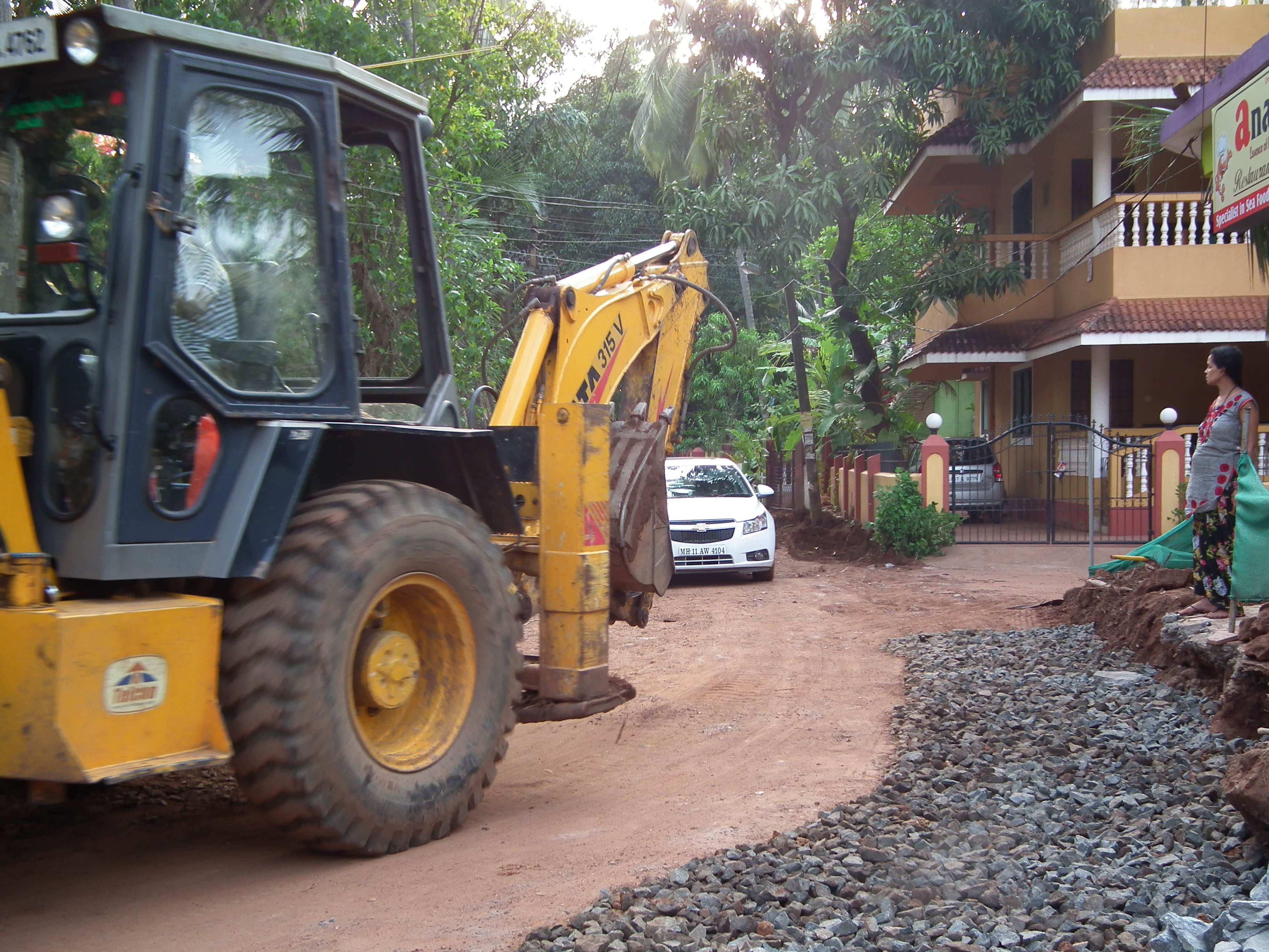
The Calangute MLA and former minister was in the news again this week. This time after the residents of Anjuna and Assagao rose up in protest over what they said was a “completely illegal” move to run a bulldozer through the main thoroughfares of the villages of Anjuna and Assagao under the guise of road expansion.
If it feels like you’ve heard this story before, it’s probably because you have. It was only last year that residents of neighbouring Siolim had to knock on the doors of the High Court after a contractor, who declined to say who engaged him, began to run his chainsaws through the age-old fruit bearing trees in private property along the roadside under the guise of road expansion.
It was only after the High Court took cognizance and the PWD claimed that it had no ongoing road expansion projects in the Siolim village or constituency, that the High Court issued a stay and the work was stopped. It turned out the work was completely illegal, wasn't being executed by any government department and had no approvals.
But you would be mistaken if you think that this bulldozer action is a recent phenomenon. The truth is that this disregard for due process dates back to Michael Lobo’s first term as an MLA.
In fact, I would encourage you to read this report I had written from more than a decade ago back when I was with Gomantak Times and GT, as it was popularly called back then was still a daily newspaper. All that remains today is a website with travel focussed stories.
But back to the point. More than ten years later little has changed. If the news report from back then sounds eerily similar to what’s happening now, it’s because the brains behind it are largely the same. It’s worked in the past and so those who did it now have the incentive to do it again.
And, if anything, if such a degree of lawlessness seemed shocking back then, it appears that no lessons have been learned and on the contrary things have gotten even more brazen now.
Lobo, who was seen defending the work even as he was being confronted by the affected villagers, has often touted his policy of development with consent, wherein according to him, people willingly come forward and offer their lands for the common good of the village and for ‘development’. While there’s no doubt that that may be true in some cases, especially if there is some ‘consideration’ involved most people are left with little choice. They had little choice back then and have little choice now.
That people have chosen to stand up to the roadside bully with earthmoving machinery at his disposal is creditable and hopefully they will find at least some of the success that the people of Siolim have (for whatever it's worth).
One mustn’t forget that it wasn’t too long ago either that Lobo had another confrontation this time in Vagator over allegedly work on clearing of a plot falling within the No Development Zone in which he was heard on camera saying that he was being questioned because he was a local, but when ‘outsiders’ undertake development within the CRZ, everyone is quiet.
It’s a bit rich coming from someone whose starred resort is facing demolition for being in violation of the CRZ regulations with the demolition already upheld by the National Green Tribunal and who was caught forging a CRZ permission to claim that the law is not being equally applied because he’s a local.
In truth, CRZ offers protection but only for structures existing prior to 1991 and that too if they belong to members of the traditional fishing community and no other. Is Lobo trying to make a case that he should be treated differently?
That’s all I have for you this week. Make sure you comment or write in, should you have something, anything to say.
I would also invite you to contribute via sending in your views, especially on a subject you know something about, and I will be happy to include it as part of the newsletter.
You are also welcome to write in with leads and tip-offs or anything that you think might be interesting enough to include here.
As always, please share and help spread the word.
Until next week, then. Tchau!
Combining Amche.in with Mr. Daryl D Costa's askpedru.com becomes a good resource.
I wonder if there is a way for both states to leave the river and the forests alone. Given the vagaries of weather and shifting climate patterns, no plan can ever deliver the fantastic projections that scheming politicians, focused on their vote banks and sugar cooperatives, which they use to expand their influence (or their equivalents on the other side of the Ghats), can dream up.